
MVMT PROJECT
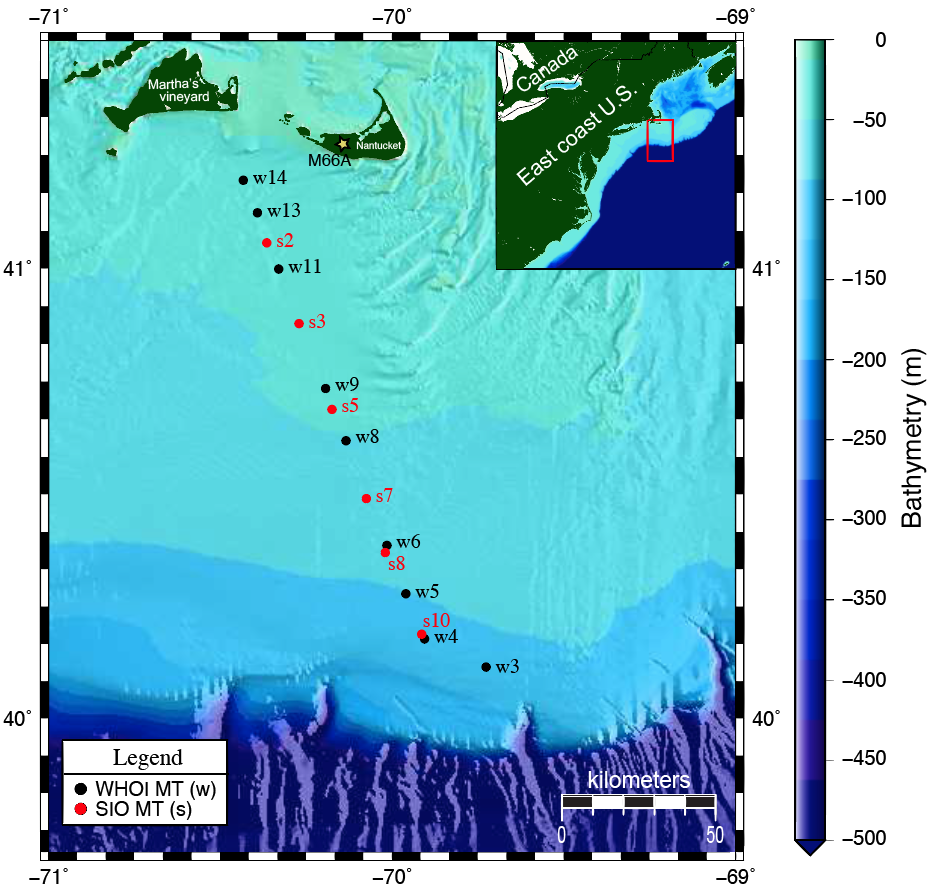
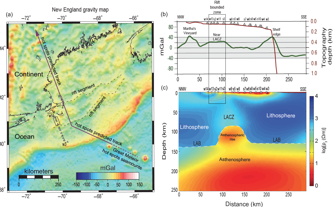
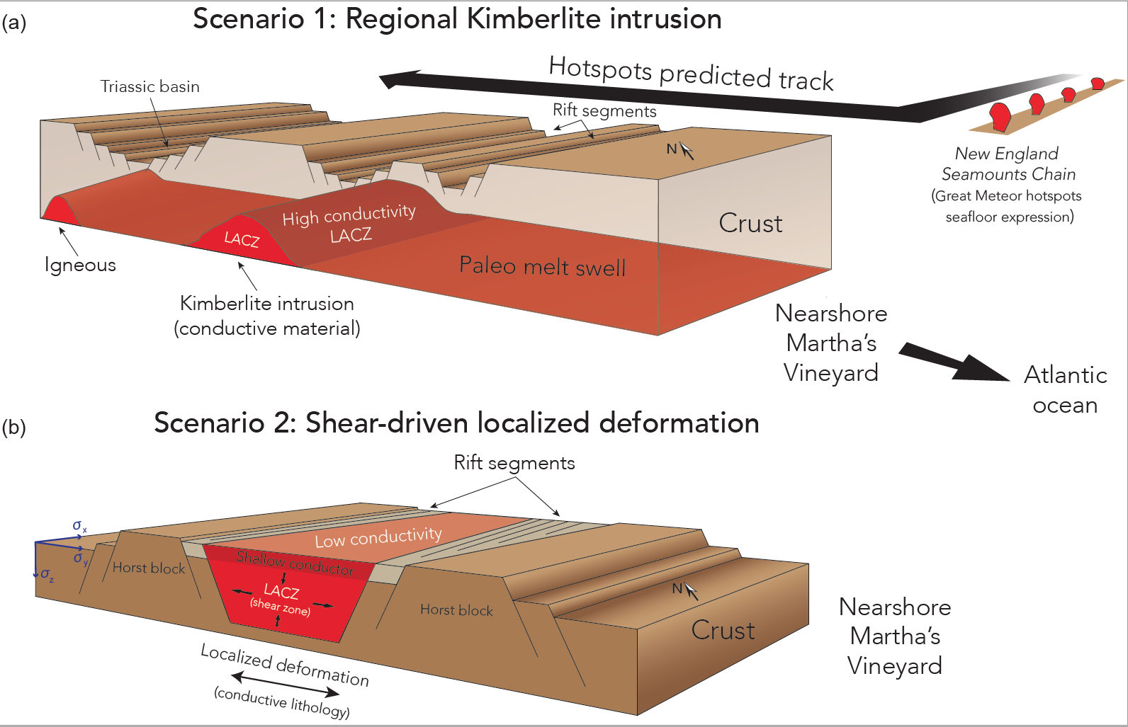
This marine MT study revealed the depth and topography of the lithosphere-asthenosphere boundary (LAB) along the eastern North America passive continental margin, nearshore of Martha's Vineyard, Massachusetts, USA. The 2-D conductivity structure of the lithosphere and asthenosphere was resolved using two different inversion methods (MARE2DEM & WinGLink). We interpret our preferred 2-D conductivity model on a broader regional scale while considering additional geophysical information such as P-to-S receiver function data, shear-wave velocity models, and localized gravity anomaly, evaluated in conjunction with regional geological features (Attias et al., 2017).
pilab project
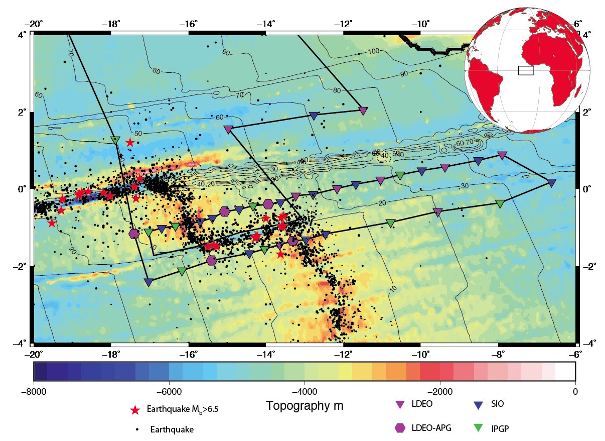
Imaging the Lithosphere-Asthenosphere Boundary and the generation of young oceanic crust at the equatorial Mid-Atlantic Ridge. This study used both MT and OBS instruments. The research groups included the University of Southampton, Scripps Institution of Oceanography, Insstitut de Physique de Paris, and GEOMAR Helmholtz Centre for Ocean Research Kiel.